
Summertime Pattern Brings Triple-Digit Heat Indices and Weekend Storms

This evening, things are relatively quiet across the region, but a classic summertime pattern is knocking on our door. If you’ve enjoyed the comfortable mid-80s today, make sure to appreciate the overnight breeze, because a major shift toward true summer heat and humidity begins tomorrow.
Here is what you need to know to plan your upcoming week:
Friday: The Heat Arrives with Spotty Storms
Tomorrow brings a much more summer-like feel as temperatures climb into the low-to-mid 90s. Thanks to a steady south-southwest breeze, humidity will be on the rise, pushing heat indices into the mid-to-upper 90s for most of us—and potentially flirting with the 100°F mark in southeastern Virginia and northeastern North Carolina.

As the afternoon peaks and wears into the evening, an approaching atmospheric disturbance will introduce a low chance of showers and thunderstorms. While the vast majority of the region will likely stay dry, the best chances for a pop-up storm sit across our northern and western zones. Because of the building heat and moisture, the few storms that do manage to break out could pack a punch, carrying a localized risk of damaging wind gusts.

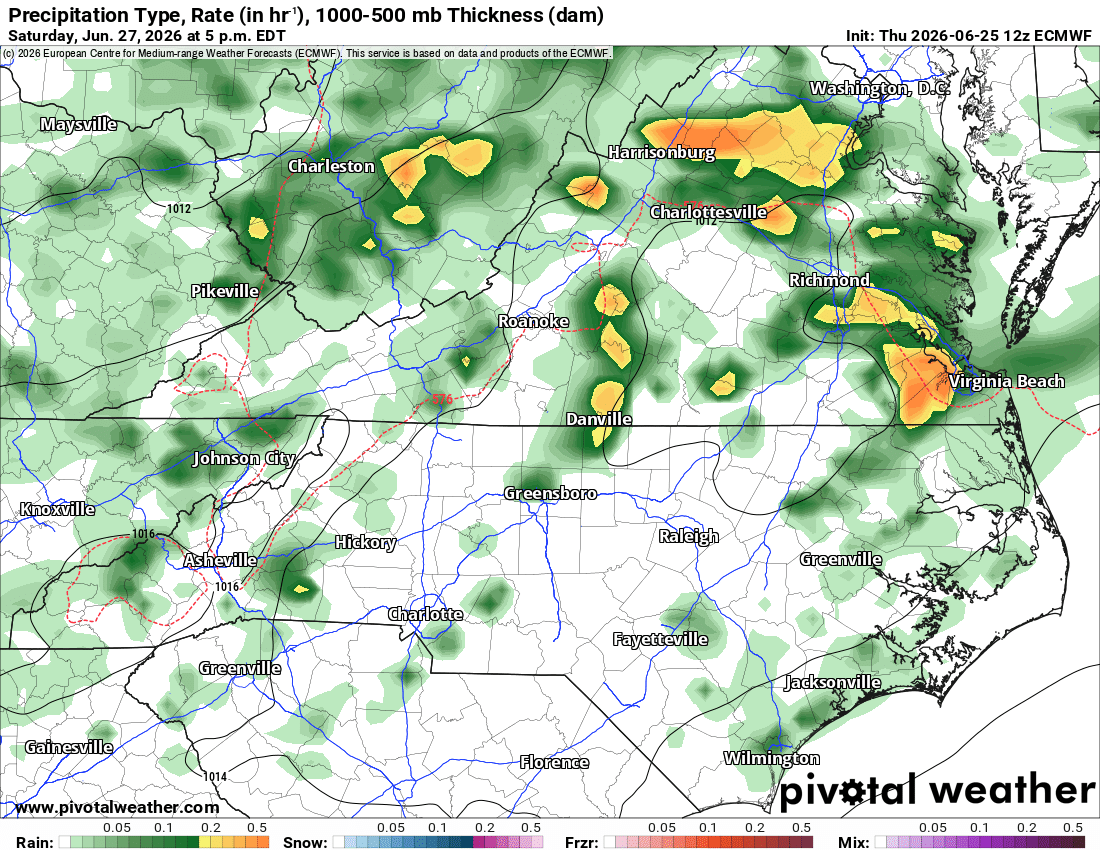
The Weekend: A Steamy Saturday Followed by a Cold Front
If you have outdoor plans this weekend, Saturday is the day to keep a close eye on the sky:
Saturday: This will be the hottest, most humid day of the stretch. Heat indices are forecast to rocket up to 100–105°F across southern Virginia and northeastern North Carolina. By Saturday afternoon and evening (specifically between 4 PM and 9 PM), a stronger weather disturbance will trigger scattered to potentially numerous showers and thunderstorms across the entire area. A few stronger, organized storms are possible, bringing localized damaging winds and heavy downpours that could cause minor flooding in urban areas.
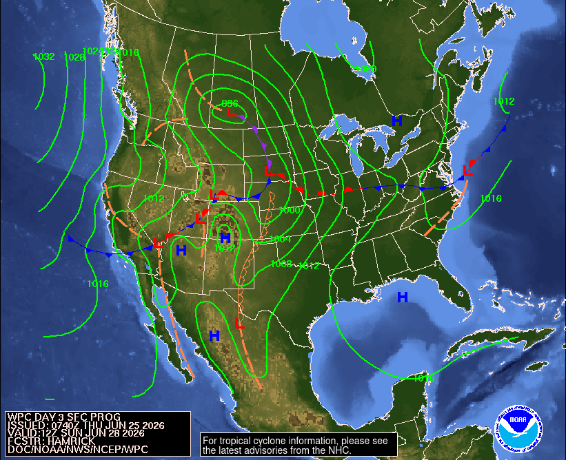
Sunday: Relief begins to slowly roll in. A cold front will slide through the region, shifting our winds to the north-northeast. Storm chances will drop compared to Saturday and will mostly be confined to our southern areas.


Next Week: A Brief Breath of Fresh Air, Then a Major Heat Wave
We kick off the final days of June with a beautiful weather gift on Monday. High pressure building in from the north will deliver dry, pleasant conditions, temperatures in the mid-to-upper 80s, and noticeably lower humidity.

Enjoy Monday and Tuesday while they last. By Wednesday, high pressure moves offshore, kickstarting a significant warming trend. Upper-level ridging will build eastward from the Mississippi River Valley, completely shutting down our storm chances while cranking the heat back up. By the middle and latter parts of next week, afternoon temperatures will surge well into the 90s, with heat indices easily climbing back above 100°F.

Marine & Beach Note: Boaters should prepare for marginal Small Craft Advisory conditions in the Chesapeake Bay tonight, with general tranquility returning this weekend outside of any sudden thunderstorm activity. For beachgoers, while the rip current risk is low through Saturday, a shift to onshore winds on Sunday will elevate the rip current risk to Moderate for Eastern Shore beaches. Stay hydrated and stay weather-aware!

Want to stay ahead of the weather? Head over to rvaweather.net for your latest, hype-free local updates! 🌤️
Don’t forget—you are my eyes and ears on the ground. Got a backyard thermometer reading, rain gauge total, or a picture of the sky? Submit your own weather observations right on the site and join the crew!
As always, keep an eye on the sky and stay safe out there! 👋