


Stalled Front, Soaked Streets – Relief Comes Just in Time for the Fourth

🔍 Overview:
A slow-moving cold front is pressing into central Virginia today, and it’s bringing more than just a polite summer sprinkle. Thunderstorm chances ramp up from west to east through tonight, and with high humidity and a juice-loaded atmosphere, some storms could mean business. Expect locally heavy rain, frequent lightning, gusty winds, and the potential for flash flooding.

Photo Credit: National Forecast Map - shows the front across the United States
This front will be in no rush to leave, lingering into Wednesday before finally pushing offshore. Behind it? A refreshingly dry airmass just in time for the Fourth of July weekend. 🎆
⛈️ Today (Tuesday): Watch the Skies
Scattered storms ignite this afternoon, becoming more widespread into the evening and overnight.
Severe Risk: A Slight Risk (Level 1 of 5) is in place for northern and northwestern areas. Strong wind gusts and wet microbursts are the main concern.
Flooding Risk: With PWATs near 2" and possible storm training, flash flooding could become an issue—especially in the Piedmont and RVA metro late tonight.
Temps: Highs in the upper 80s to low 90s, with sticky dew points pushing heat indices near 100°F.
🌀 A Severe Thunderstorm Watch is in effect for the northern half of the area through 9 PM.
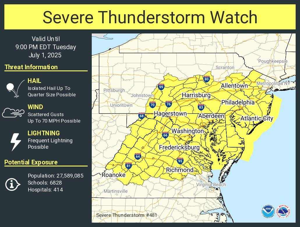
Photo Credit: National Weather Service office in Wakefield - Severe Thunderstorm Watch #481
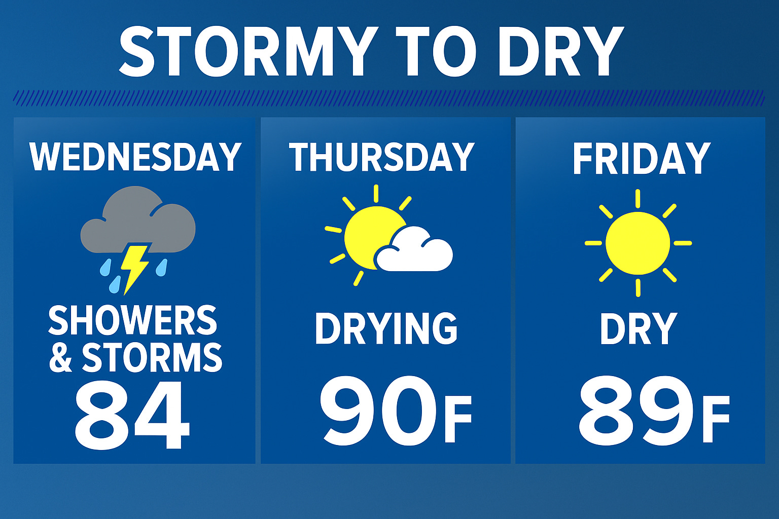
🌧️ Wednesday: Soggy Southeast, Drying Northwest
The front slows and stalls near the VA/NC border, focusing showers and storms mainly across SE VA and NE NC.
Rain could be very heavy in spots—don’t be surprised by localized 2–3" totals.

Photo Credit: Pivotal Weather NAM 3km CONUS - showers for Wednesday morning.
Flood Watch Possible: Overnight shifts may issue one depending on convective trends.
Severe Weather? Not off the table. There’s some modest low-level shear, and while the tornado threat is low, it’s non-zero.
Temps: Mostly in the 80s, possibly cooler where clouds and rain linger longest.
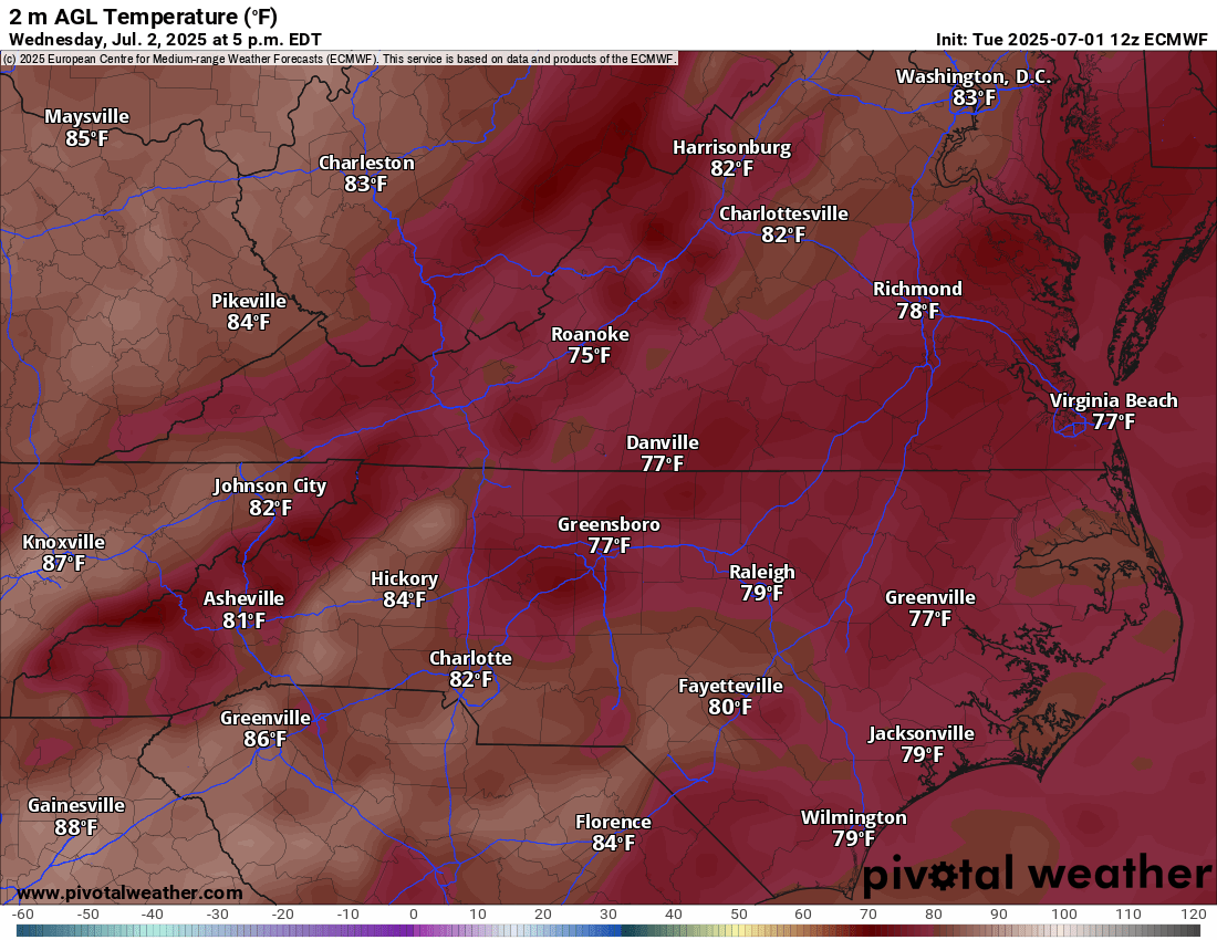
Photo Credit: Pivotal Weather ECMWF Forecast Model - cooler temperatures for Wednesday.


🌤️ Thursday: Transition Day
Drier air filters in from the northwest. Just a stray shower possible in NE NC.
Highs bounce back into the low 90s, but dew points drop into the 60s—making it more tolerable.
A secondary front may pass dry and unnoticed, but helps reinforce that improving trend.

Photo Credit: Pivotal Weather ECMWF Forecast Model - warmer temps for Thursday

🇺🇸 Independence Day Forecast – Friday:
Cue the star-spangled banners and watermelon wedges—we’ve got a winner:
Dry, Sunny & Warm: Highs in the upper 80s to near 90°F.
Humidity? Manageable, thanks to dew points in the 60s.
Fireworks Friendly? Absolutely.

Photo Credit: Pivotal Weather ECMWF Forecast Model - temps to start your long weekend.

🌱 Gardeners’ Note:
You’ll want to skip watering Tuesday or Wednesday—Mother Nature’s got that covered. But check for drainage issues and be mindful of flash flooding in low-lying areas.
⚠️ Final Word:
We’re in a textbook summertime setup—hot, humid, and stormy ahead of the front… with welcome relief once it passes. Stay alert today and tonight, especially for any severe weather and flash flooding, then plan to enjoy a quiet, pleasant Fourth of July with friends and fireworks.
For radar updates and real-time alerts, follow us on all platforms using #rvawx.
🌦️ Stay aware and weather-wise,
Richard Foreman
Sky Spectrum Studios | Nature’s Narrative
📍 Richmond, VA
📸 YouTube