
Post-Storm Update: Dangerous Cold, Tidal Flooding, and a Mid-Week Peek

The bulk of the weekend’s winter storm has moved offshore, but don’t let the clearer skies fool you—today is all about the “Big Chill” and rising waters.
While we’ve been able to cancel several Winter Weather Advisories and Storm Warnings, the hazards have shifted from falling snow to biting cold and coastal flooding. Here is everything you need to know for the next few days.
1. The Deep Freeze
The snow has largely exited, but it’s left behind a brutal thermal footprint.
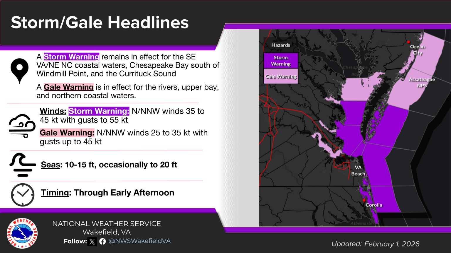
The Status: Extreme Cold Warnings and Cold Weather Advisories remain in effect through mid-morning.

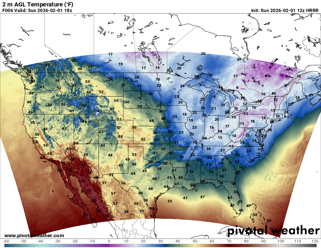
Photo Credit: Pivotal Weather HRRR Forecast Model - Sunday High The Feel: With wind gusts hitting 40–50 mph near the coast, wind chills are hovering near or below zero. They likely won’t climb out of the single digits until well into the afternoon.

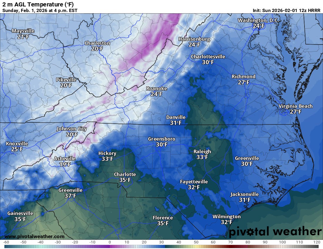
Photo Credit: National Weather Service in Wakefield Travel Hazards: Even where the snow has stopped, gusty winds are causing blowing snow, which can suddenly drop visibility. If you are in Southside Hampton Roads or NE North Carolina, watch for slick spots where the “dry, fluffy” snow has drifted.
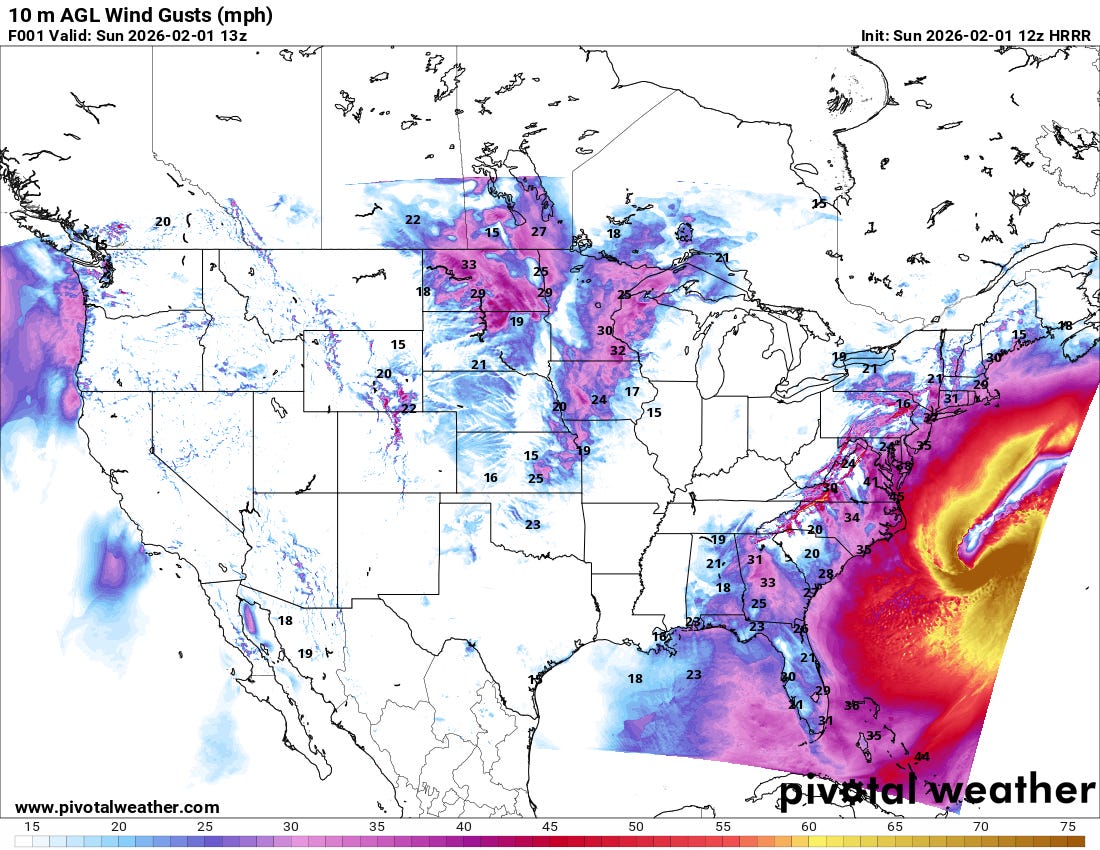
Photo Credit: Pivotal Weather HRRR Forecast Model - High winds

2. Coastal Flooding Concerns
The low-pressure system off the coast is deepening, and it’s pushing a lot of water our way.
Major Flooding: Expected along the Atlantic coast of NE North Carolina.
Moderate Flooding: Expected for Virginia Beach and portions of Southside Hampton Roads.
The Timing: High tide this morning is the primary window of concern. Coastal Flood Warnings remain active for these areas.
3. Warning & Advisory Changes
We have begun scaling back the winter alerts as the system pulls away:
Cancelled: Winter Storm Warnings for Greensville, Southampton, Isle of Wight, Suffolk, Hampton/Poquoson, and Northampton (VA).
Wind Updates: High Wind Warnings have been downgraded to Wind Advisories for most areas. However, VA Beach and Eastern Currituck remain under High Wind Warnings for now.

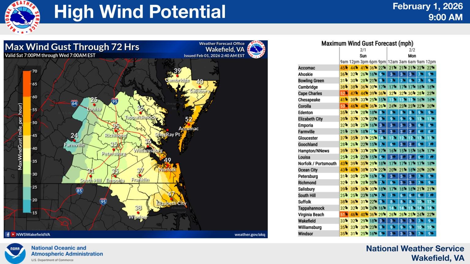
Photo Credit: National Weather Service in Wakefield
Looking Ahead: More Snow Mid-Week?
After a brief thaw and a dry start to the work week, we are already tracking a new front arriving mid-week.
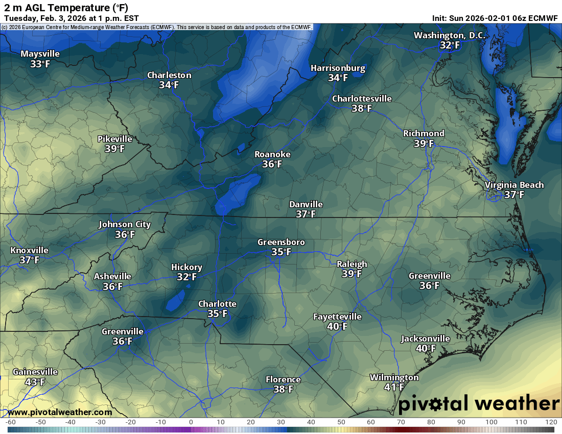
The Outlook: This doesn’t look like a major event at this stage. Guidance suggests a rain/snow mix with the “cold air chasing the moisture”—a setup that historically doesn’t produce massive totals in our region.
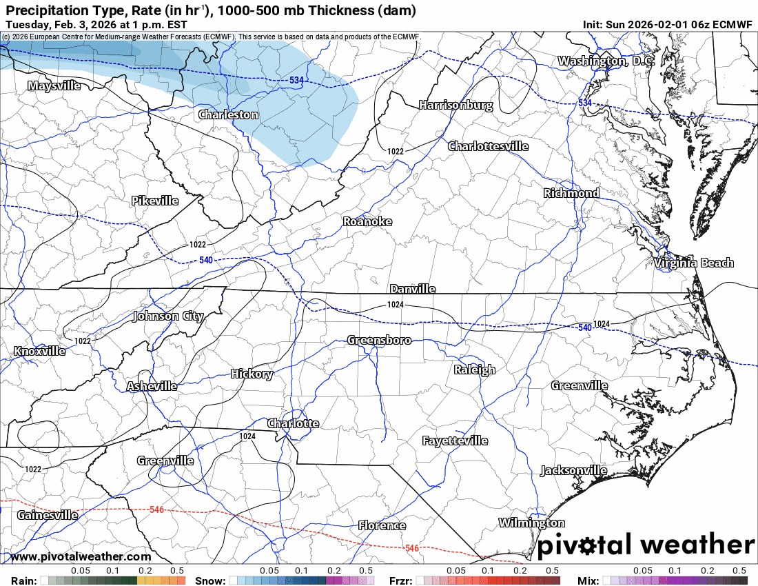
Accumulations: Generally expected to be one inch or less.
Primary Target: Northern counties have the best chance of seeing light accumulations, while the rest of us will likely see a cold rain or a brief changeover on the backside of the system.
Stay warm, stay off the roads if you can this morning, and keep an eye on those tide levels.

Thanks for tuning into the RVA Weather Brief!
If this update helped you plan your day, please
Like this post,
Share it with your neighbors,
Comment below with your local snow totals or road conditions.
Stay safe and stay warm out there!