
Brace Yourselves: A Quick Dusting, Then the Deep Freeze

If you were hoping for a major winter wonderland this weekend, I have some “good” news and some “bracing” news. We are looking at a classic “blink-and-you’ll-miss-it” snow event followed by a legitimate, bone-chilling cold snap that will make Saturday feel like a survival mission.
Here is the breakdown of what’s coming our way over the next 48 hours.
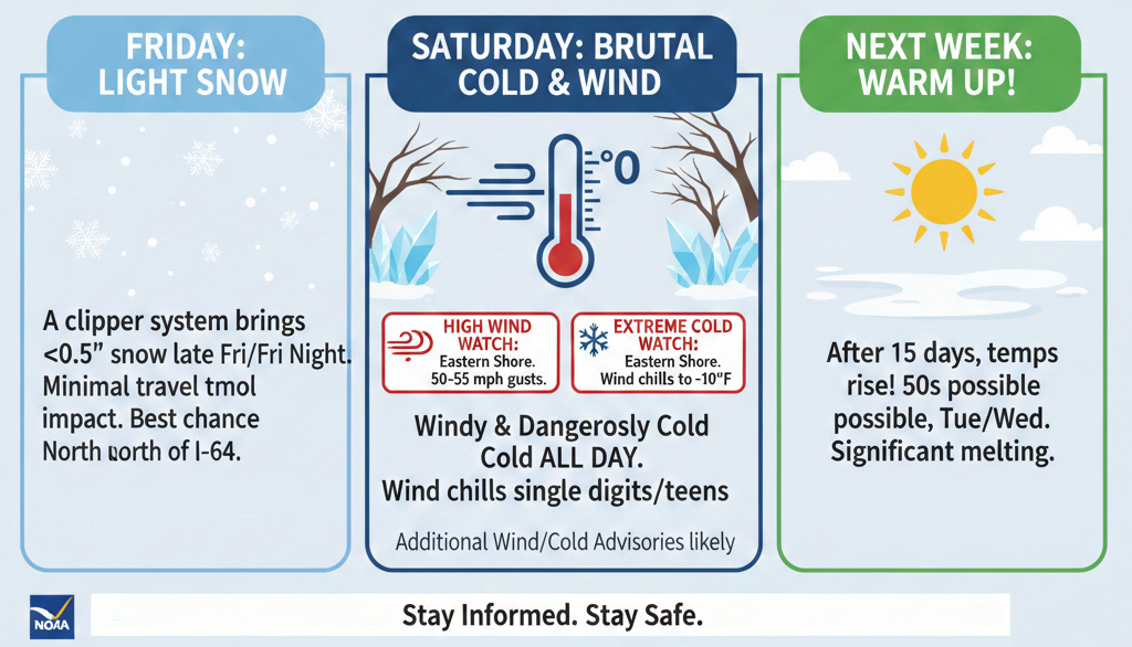
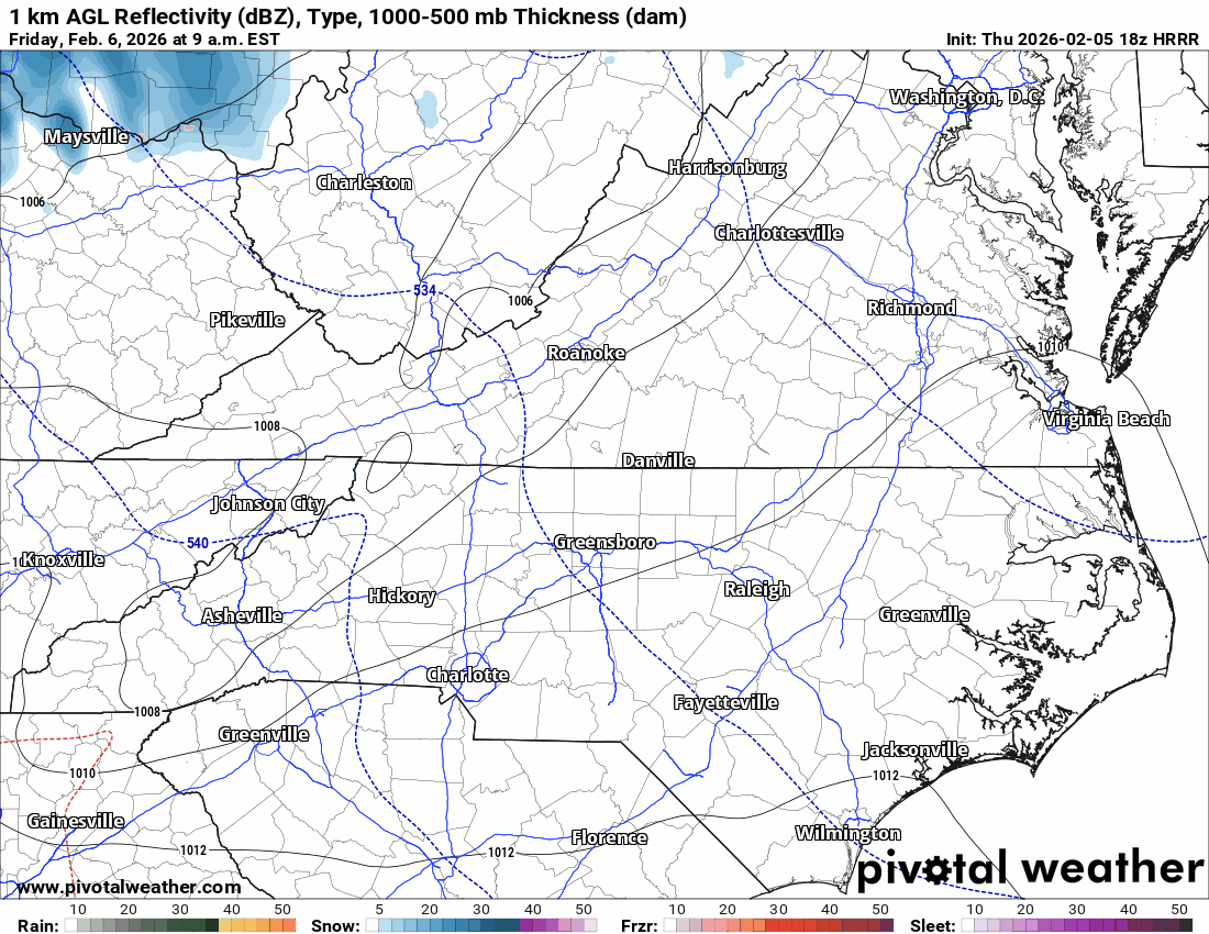
1. The Friday “Clipper”: Light Snow, Low Impact
A quick-moving clipper system arrives late Friday into Friday night. While “snow” is the headline word, don’t go hunting for the sled just yet.
The Forecast: We’re looking at very light accumulation—less than 0.5” for most.
The Transition: It’ll likely start as rain or a mix as temperatures hover near 40°F, switching to light snow as the air saturates.
The Impact: Minimal. Because ground temperatures are relatively high and the intensity is low, travel impacts aren’t currently expected. The best chance for seeing white on the grass is north of I-64.

Photo Credit: Pivotal Weather HRRR Forecast Model - Clipper System
2. Saturday: The Main Event (And It’s Cold)
Once the clipper exits, the real story begins. A massive pressure drop offshore will act like a vacuum, pulling down brutal Arctic air and cranking up the wind.
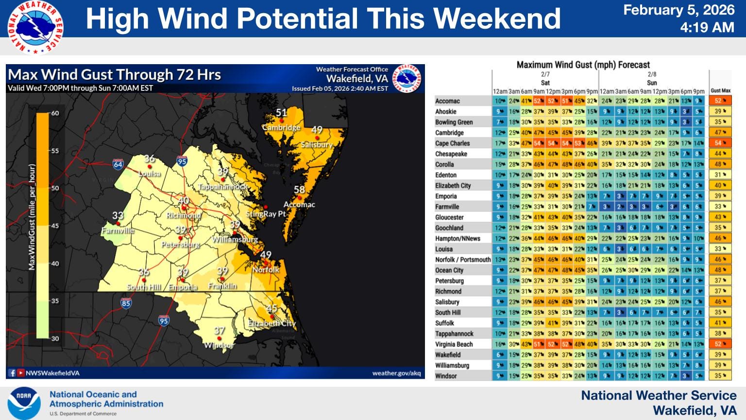
The Winds: A High Wind Watch is in effect for the Eastern Shore, where gusts could hit 50–55 mph. Areas east of I-95 should prepare for gusts between 35–50 mph.
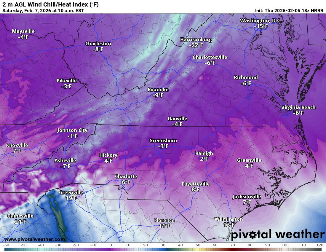
The Cold: This isn’t just “jacket weather.” An Extreme Cold Watch has been issued for the Eastern Shore.
Wind Chills: On Saturday night, wind chills are forecast to plunge as low as -10°F. Even during the day Saturday, “feels like” temperatures will struggle to leave the single digits in the north.

Photo Credit: Pivotal Weather ECMWF Forecast Model - Saturday High
3. The Light at the End of the Tunnel
If you can make it through Sunday morning, there is a massive reward waiting on the other side. For the first time in nearly 15 days, we are going to see a significant pattern shift.
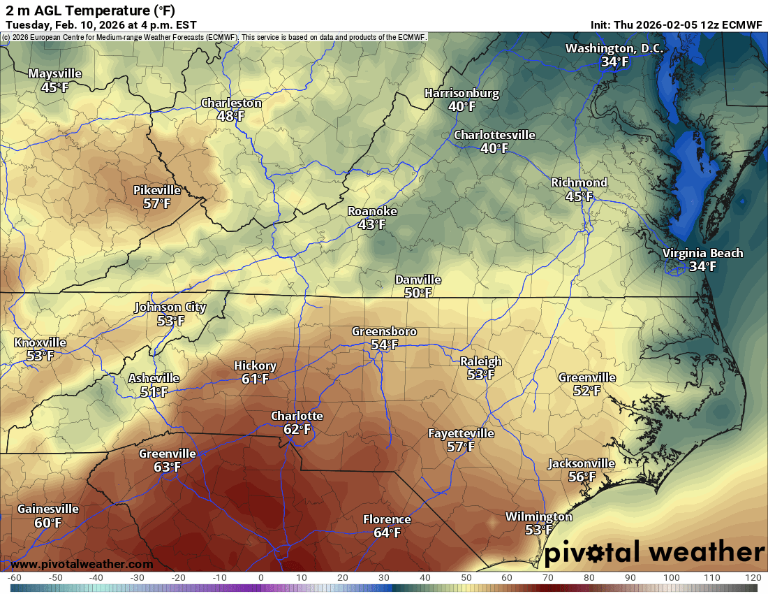
Next Week: Temperatures are expected to climb into the 50s by Tuesday and Wednesday.

Photo Credit: Pivotal Weather ECMWF Forecast Model - Tuesday High The Great Thaw: This warmup will finally melt away the stubborn ice and snow packs that have lingered over the last two weeks.
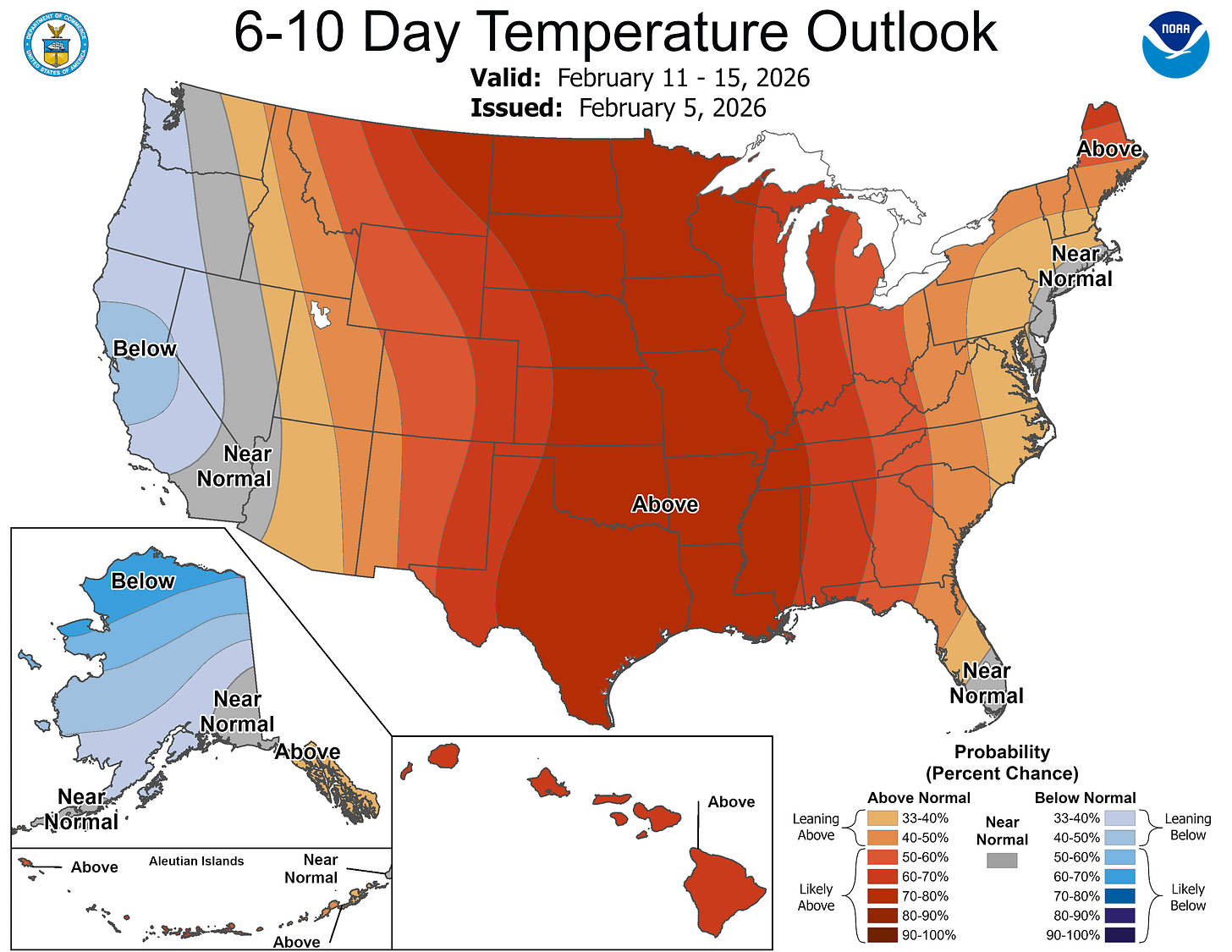
Photo Credit: Climate Prediction Center

Bottom Line: Keep the faucets dripping and the pets inside Saturday night. It’s going to be a rough 36 hours, but spring-like relief is only a few days away.
Current Watches & Warnings:
High Wind Watch: Eastern Shore (Sat/Sat Night)
Extreme Cold Watch: Eastern Shore (Wind chills to -10°F)
Expected: Wind and Cold Weather Advisories for areas east of I-95.
📌 PINNED MESSAGE
Staying warm is a team sport!
🧥 If this brief helped you plan your weekend, please Like and Share to keep our RVA community prepared.
👇 COMMENT BELOW: Are you Team "One Last Snow" or Team "Bring on the 50s"?