

Atmospheric Update: Tracking Triple Threats (Heat, Fire, and Easter Storms)

If you were outside today, you probably noticed two things: it felt suspiciously like June, and the wind was doing its best to remind us that spring isn’t quite finished with its mood swings.

We’ve had high pressure anchored offshore today, which basically acted like a giant hair dryer, pumping deep southwest flow across the Carolinas and into our neck of the woods. Temperatures hit the low 80s for many of us, and while the Eastern Shore stayed a bit cooler thanks to the Chesapeake Bay, the rest of the region felt the heat.

Here is what’s on the radar (literally and figuratively) as we head into the rest of the week.
The Midweek Outlook: Heat vs. Storms
Tomorrow looks like a record-breaker. We’re watching the ridge build even further, which could push temperatures into the mid-to-upper 80s. Norfolk is currently the “favorite” to break its record high tomorrow, so maybe don’t pack the heavy sweater for the office just yet.

However, with that heat comes a bit of instability. A stationary front to our north is expected to sag southward tomorrow afternoon. Combined with a surface trough near the mountains, we’re looking at scattered showers and storms developing out west and moving into the VA Piedmont and MD Eastern Shore by Wednesday evening.

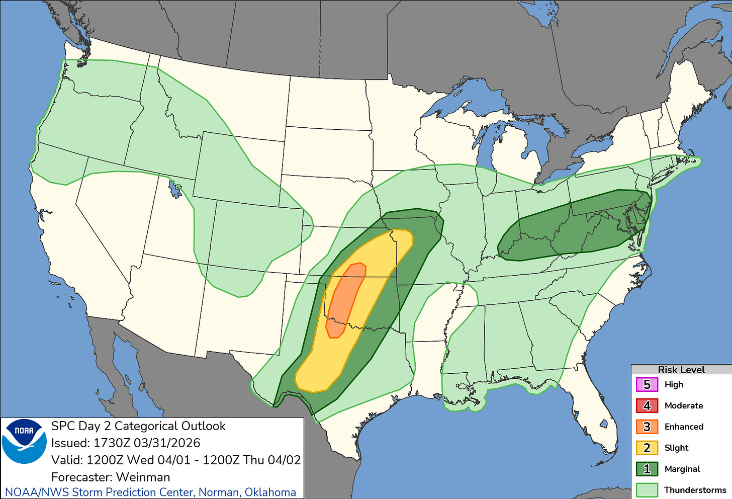
The Risk: The Storm Prediction Center has expanded the Marginal Risk (Level 1 of 5) further south. This now covers the northern third of our area, including the northern parts of the Richmond metro.
The Threat: If a storm turns severe, the primary concerns are damaging wind gusts and perhaps some marginal hail.


Looking Toward the Holiday Weekend
Once we get past Wednesday’s storm potential, the ridge settles back in. Thursday through Saturday should be gorgeous and primarily dry, with highs staying solidly in the 80s.

But, as is tradition for outdoor holiday plans, Easter Sunday brings a cold front. Current models are showing a line of showers and storms moving through Sunday evening. It’s too early to pin down exact timing, but if you have an Easter egg hunt or a family cookout planned, you’ll want to keep an eye on the forecast. We could see some stronger storms as that front pushes through, followed by a much cooler Monday in the 50s and 60s.

A Final Note on Fire Safety
While it feels humid-ish to some, it’s actually quite dry out there. We are still dealing with increased fire danger, particularly in interior northeast North Carolina.

Important: With wind gusts up to 20 mph and ongoing drought conditions, please be extremely careful with any outdoor burning or discarded smoking materials through Wednesday evening.

Enjoy the “Pre-Summer” warmth while it lasts—and maybe have a backup plan for Sunday dinner!

To me this is summer weather in spring with spring pollen blowing the summer wind.
I find it really helpful to have a clear written forecast to refer to. Thanks for providing that to your readers!
Did today feel like spring or summer to you? Let me know your local high temp in the comments, and don't forget to share this update with your Easter Sunday hosts!